| Content from Wikipedia under the CC BY-SA 4.0 license ⇔ Maps from OpenStreetMap under the ODbL license |
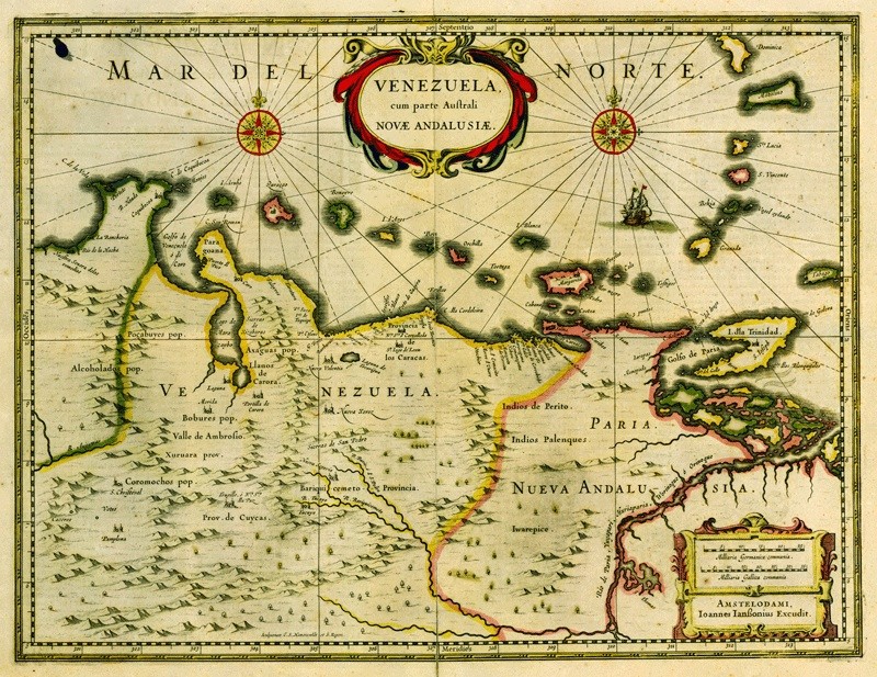
File:Mapa de Venezuela 1635.jpg
From Hispanopedia
Original file (800 × 617 pixels, file size: 252 KB, MIME type: image/jpeg)
Summary
| Description | Venezuela cum parte Auẝtrali Novae Andalusiae (La provincia de Venezuela y la parte austral de Nueva Andalucía). Mapa del año 1635. |
| Date | |
| Source |
Instituto Geográfico Simón Bolívar http://www.fpolar.org.ve/nosotros/educacional/instituc/capigene.html |
| Author | Joannes Janssonius Excudit |
Licensing

|
This work is in the public domain in its country of origin and other countries and areas where the copyright term is the author's life plus 100 years or fewer.  You must also include a United States public domain tag to indicate why this work is in the public domain in the United States. |
| This file has been identified as being free of known restrictions under copyright law, including all related and neighboring rights. | |
File history
Click on a date/time to view the file as it appeared at that time.
| Date/Time | Thumbnail | Dimensions | User | Comment | |
|---|---|---|---|---|---|
| current | 05:57, 23 March 2009 | No thumbnail | 800 × 617 (252 KB) | wikimediacommons>Milenioscuro | mas brillo |